Eos Arrow Gold GNSS Receivers
Features
- Supports GPS, GLONASS, Galileo & BeiDou
- 100% Android, iOS, Windows compatible
- 1cm RTK real-time accuracy
- Free ground shipping
- Expedited repair and warranty service
- Lifetime technical support
- More
The World’s Most Advanced GNSS Receiver for Every Mobile Device
The Eos Arrow Gold is a high-accuracy Bluetooth GNSS receiver that implements all four global GNSS constellations (GPS, GLONASS, Galileo, BeiDou), multi-frequency, and satellite-based RTK augmentation on iOS, Android, and Windows. Moreover, the new Arrow Gold+ adds full-band support for all GNSS signals, including Galileo’s free High-Accuracy Service (HAS). Both the Arrow Gold® and Arrow Gold+™ receivers support connection to popular apps like Esri’s ArcGIS apps and other mobile GIS apps on iOS, Android, and Windows.
RTK in Poor Cell Coverage Areas
SafeRTK is the answer. SafeRTK is a proprietary feature included exclusively with the Arrow Gold and Arrow Gold+ receivers. When cellular connection to the RTK network drops, SafeRTK takes over within a few seconds and maintains RTK-level accuracy for up to 20 minutes. This enables uninterrupted RTK accuracy in spotty areas.
No RTK Network?
The Arrow Gold supports low-cost global corrections. The Eos Arrow Gold features a 4cm, real-time satellite correction service called Atlas, available globally. Using all four constellations and signals, the Arrow Gold offers convergence times as low as 15 minutes at a revolutionary price point.
Multiplexing with the Arrow Gold+
The Arrow Gold+ has the functionality of the Eos Bridge Bluetooth connector built-in. Connect the Arrow Gold+ to any third-party sensor (e.g., laser rangefinder). The Arrow Gold+ will stream the content of that sensor to a chosen iOS or other mobile devices via the receiver’s own location datastream.
Ultimate Flexibility in Mobile Accuracy
iOS, Android, and Windows compatibility is our expertise. Eos Positioning Systems offers GNSS hardware with some of the most innovative, advanced connectivity on the market, supporting connection to popular apps like Esri’s ArcGIS and other mobile GIS apps.
- (1) Arrow Gold receiver with USB & Serial ports
- (1) Arrow Smart Battery Pack
- (1) L1/L2/L5 / LBand Precision Antenna
- (1) Large Antenna Mounting Plate
- (1) Two-section Short Antenna Cable for survey pole
- (1) Arrow Pole Mount Bracket
- (1) Range Pole Clamp
- (1) USB Data Cable
- (1) 12V International Power Supply for Arrow Smart Battery pack
- (1) Hard Shell Case
In The News
Applied Research and Innovative Solutions: Creating CHNGES at Western Kentucky University
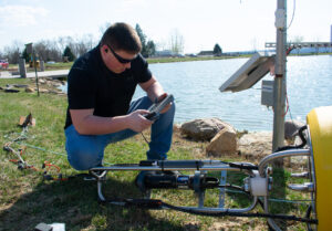
Long-standing environmental monitoring programs have the power to support a large number of research initiatives and policy changes—however, actually starting these networks can prove challenging. Not only is starting the program difficult, but keeping things operational for decades to come has also been challenging for environmental professionals hoping to make an impact with applied research. Jason Polk, Professor of Environmental Geoscience and Director of the Center for Human GeoEnvironmental Studies (CHNGES) at Western Kentucky University, is all too familiar with this process.
Read MoreCombating Water Insecurity in Saskatchewan with Real-Time Data
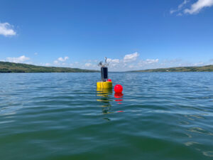
The prairies of Saskatchewan can be described as one of the least water-secure parts of Canada, making water quality monitoring essential for informed resource management in a region already facing water insecurity. While natural physical properties worsen some of the poor water quality conditions in the region, others are connected to land use. Having grown up spending summers on the shores of Lake Huron, Helen Baulch, an associate professor at the School of Environment and Sustainability at the University of Saskatchewan , has always been dedicated to the protection of water resources. Looking back fondly at her childhood playing along the shore, Baulch also recalls the invasion of quagga mussels during her teenage years and watching the lake change as a result.
Read MoreSeametrics Turbo Turbidity Logger: Boost your Turbidity Monitoring
The Seametrics Turbo Turbidity Logger is a self-cleaning turbidity sensor capable of internally logging over 260,000 data records. The sensor enables researchers, compliance officers, and contractors to monitor turbidity in various applications, from construction and dredging sites to wastewater effluent. Due to its narrow width, this device can be deployed in a range of areas, from small well spaces to rivers and streams. The stainless steel housing and built-in wiper allow the sensor to withstand long-term deployments and reduce the need for maintenance trips. The logger accurately records temperature and turbidity up to a depth of 50 meters.
Read More


