
Geneq SXblue Platinum GNSS Receiver
Features
- GPS, GLONASS, Galileo, BeiDou, QZSS and SBAS
- Android, iOS and Windows compatible
- Triple-frequency L1-L2-L5 with 1cm RTK accuracy
- Free ground shipping
- Expedited repair and warranty service
- Lifetime technical support
- More
Overview
Powered by its 394 channels, the Geneq SXblue Platinum uses all-in-view constellations with triple frequency and offers the ability to use a global or local coverage of corrections (SBAS, L-Band and RTK). The internal, rechargeable, field-replaceable Li-Ion battery has onboard LEDs to access battery life information easily.
Upgradable
With the scalable SXblue Platinum Basic, the user can activate at anytime any frequency or constellation after its initial purchase. The receiver is also field upgradable which means that options can be activated remotely.
Streaming Potential
Atlas delivers its correction signals via L-band, or it can stream data over the internet (NTRIP) at accuracies ranging from meter to subdecimeters levels, ensuring the best available vertical and horizontal accuracy.
Highly Compatible
Examples of the many compatible softwares are ESRI Collector, ArcPad, Fulcrum, TerraGo Edge, MicroSurvey FieldGenius, etc. iSXBlue RTN, a free iOS application for NTRIP/DIP configuration, is available on the App Store.
- (1) SXblue Platinum GNSS with battery
- (1) Multi-GNSS antenna (L1, L2, L5, L-BAND)
- (1) Antenna cable 10cm SMAR(M)/BNC(F)
- (1) Antenna cable 15cm SMAR(M)/BNC(M)
- (1) Charger - LI-ION 8.4 V
- (1) Serial cable, RS-232
- (1) USB cable
- (1) Pole clamp with slot
- (1) L shaped bracket for SXblue
- (1) Antenna mounting plate
- (1) Hard shell case for SXblue
Select Options


In The News

Applied Research and Innovative Solutions: Creating CHNGES at Western Kentucky University
Long-standing environmental monitoring programs have the power to support a large number of research initiatives and policy changes—however, actually starting these networks can prove challenging. Not only is starting the program difficult, but keeping things operational for decades to come has also been challenging for environmental professionals hoping to make an impact with applied research. Jason Polk, Professor of Environmental Geoscience and Director of the Center for Human GeoEnvironmental Studies (CHNGES) at Western Kentucky University, is all too familiar with this process.
Read More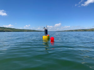
Combating Water Insecurity in Saskatchewan with Real-Time Data
The prairies of Saskatchewan can be described as one of the least water-secure parts of Canada, making water quality monitoring essential for informed resource management in a region already facing water insecurity. While natural physical properties worsen some of the poor water quality conditions in the region, others are connected to land use. Having grown up spending summers on the shores of Lake Huron, Helen Baulch, an associate professor at the School of Environment and Sustainability at the University of Saskatchewan , has always been dedicated to the protection of water resources. Looking back fondly at her childhood playing along the shore, Baulch also recalls the invasion of quagga mussels during her teenage years and watching the lake change as a result.
Read More
Seametrics Turbo Turbidity Logger: Boost your Turbidity Monitoring
The Seametrics Turbo Turbidity Logger is a self-cleaning turbidity sensor capable of internally logging over 260,000 data records. The sensor enables researchers, compliance officers, and contractors to monitor turbidity in various applications, from construction and dredging sites to wastewater effluent. Due to its narrow width, this device can be deployed in a range of areas, from small well spaces to rivers and streams. The stainless steel housing and built-in wiper allow the sensor to withstand long-term deployments and reduce the need for maintenance trips. The logger accurately records temperature and turbidity up to a depth of 50 meters.
Read More